Mount Kilimanjaro
A Guide to Africa’s Highest Peak
Rising dramatically above the plains of northeastern Tanzania, Mount Kilimanjaro is one of the world’s most recognizable mountains. Its snow-dusted summit, broad volcanic slopes, and remarkable range of landscapes have made it a destination for trekkers and nature enthusiasts from around the globe. But Kilimanjaro is more than a striking silhouette: it is a place shaped by volcanic forces, shifting climates, and a long history of human exploration.
Whether you are considering a climb or simply want to understand this famous landmark, learning about Kilimanjaro’s geography, ecosystems, routes, and challenges reveals what makes it so extraordinary.
Where Is Mount Kilimanjaro?
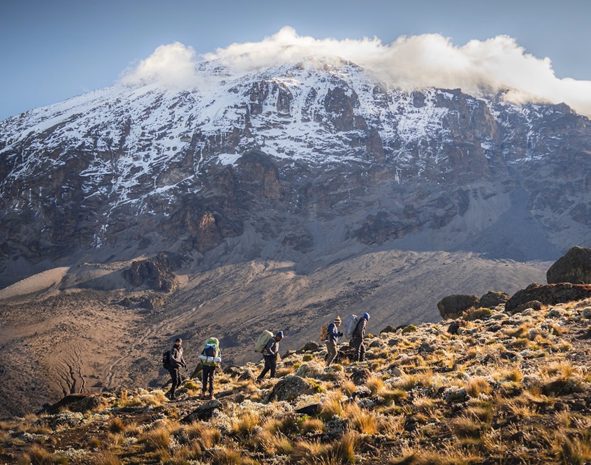
Mount Kilimanjaro is in northern Tanzania, near the border with Kenya. It stands within Kilimanjaro National Park, a protected area recognized as a UNESCO World Heritage Site. The mountain rises from the surrounding plateau to 5,895 meters (19,341 feet) above sea level, making it the highest mountain in Africa.
Kilimanjaro is also the world’s tallest free-standing mountain—a peak that rises independently rather than forming part of a larger mountain range. Its great height and isolated position allow visitors to see striking changes in climate and vegetation over a relatively short horizontal distance.
A Volcano with Three Peaks
Kilimanjaro is a volcanic massif made up of three main cones:
- Kibo is the highest cone and the location of Uhuru Peak, the mountain’s summit.
- Mawenzi is a jagged, heavily eroded peak with steep ridges. It is not a trekking summit.
- Shira is the oldest cone. It has eroded into a broad plateau and is lower than the other two.
Kilimanjaro is considered dormant, not extinct. Kibo’s summit area includes a crater and volcanic features, though there is no active eruption. The mountain’s present form developed through successive volcanic activity over a long geological period, followed by erosion and glaciation.
Five Climate Zones on One Mountain
Climbing Kilimanjaro is often described as traveling from the tropics to the Arctic. The mountain’s elevation creates distinct ecological zones, each with its own climate and plant and animal life.
-
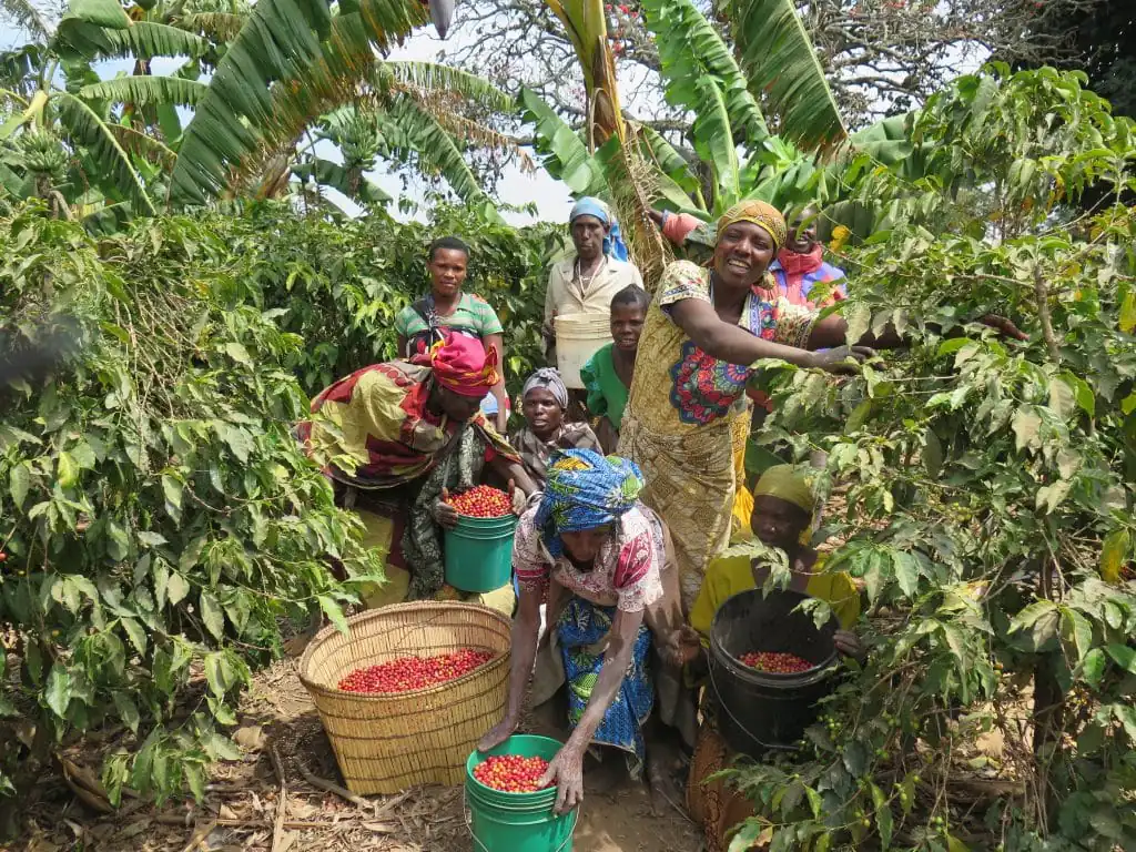
- Cultivated foothills: Farms and settlements surround the mountain’s lower slopes, where the fertile volcanic soils support crops such as coffee and bananas.
- Montane forest: Higher up, dense forest receives abundant moisture. Colobus monkeys, birds, and other wildlife live here.
- Heath and moorland: The forest gives way to open terrain with grasses, shrubs, and unusual plants such as giant groundsels and lobelias.
- Alpine desert: At higher elevations, conditions become dry, windy, and extreme. Sparse vegetation survives amid rock and volcanic debris.
- Arctic summit zone: Near the top, temperatures can fall well below freezing. Ice, snow, and glaciers occupy parts of the summit, where little vegetation grows.
These zones are not perfectly uniform, and their boundaries can vary with location and weather. Still, the rapid transitions help make Kilimanjaro’s ascent an unusually vivid lesson in altitude and ecology.
The Glaciers and a Changing Climate
Kilimanjaro’s summit is famous for its ice fields and glaciers. Over the past century, however, the mountain’s ice cover has shrunk substantially. Researchers point to changes in temperature, humidity, cloud cover, and precipitation as factors influencing the glaciers; the details are complex, and no single explanation accounts for every change.
The ice is an important symbol of environmental change, but it is not the mountain’s only climate story. Shifting rainfall patterns can also affect forests, water supplies, agriculture, and communities on the slopes. Continued monitoring helps scientists understand how mountain environments respond to both local and global conditions.
Climbing Kilimanjaro
Kilimanjaro is a non-technical trekking mountain, meaning climbers do not normally need ropes or specialized mountaineering skills on standard routes. That does not make the climb easy. The main challenge is altitude: the air becomes thinner as hikers ascend, and the body needs time to adjust.
Several established routes lead toward the summit. They differ in scenery, duration, terrain, and camping arrangements. Common options include:
- Marangu: A well-known route with hut accommodation, often completed in fewer days than some alternatives.
- Machame: A scenic route that approaches from the south and is popular with trekkers.
- Lemosho: A longer western approach that offers time for acclimatization and varied scenery.
- Rongai: A quieter route that begins from the north, near the Kenyan border.
- Northern Circuit: A longer route that makes a broad circuit around the mountain and allows an extended ascent.
Route names and itineraries can vary by operator. In general, a longer itinerary gives hikers more time to acclimatize, though no schedule can guarantee that a person will avoid altitude illness.
Altitude and Acclimatization
At high altitude, the body receives less oxygen with each breath. Some hikers experience symptoms such as headache, nausea, dizziness, tiredness, or loss of appetite. Severe altitude illness can be dangerous and requires prompt descent and medical attention.
Guides commonly encourage a slow pace, regular hydration, and careful monitoring of symptoms. Trekkers should also choose an itinerary with adequate acclimatization time and discuss health concerns with a qualified medical professional before the trip. Reaching the summit is never worth ignoring serious symptoms.
What to Expect on Summit Night
Many itineraries begin the final push toward Uhuru Peak during the night. Starting in darkness allows climbers to reach the summit around sunrise, when the light can reveal the crater and surrounding landscape. It is also one of the coldest and most physically demanding parts of the climb.
Even fit hikers can find summit night difficult. Cold, fatigue, steep slopes, and altitude combine to make steady pacing important. Some climbers reach the summit; others turn back because of symptoms, weather, or exhaustion. Both outcomes deserve respect: a safe descent is the priority.
People and History
The Chagga people have long lived on Kilimanjaro’s southern and eastern slopes, where farming and settlement have adapted to the mountain’s varied environments. Their knowledge, labor, and traditions are closely connected to the region’s history and landscape.
The mountain also became a focus of European exploration during the nineteenth century. In 1889, German geographer Hans Meyer and Austrian mountaineer Ludwig Purtscheller reached the summit of Kibo during a major expedition. Today, Kilimanjaro’s climbing industry supports guides, porters, cooks, park staff, and local businesses. Responsible tourism includes choosing operators that treat workers fairly and follow park rules.
Planning a Responsible Visit
- Choose a reputable operator like JN Travel & Tours with clear safety procedures and fair treatment of its staff.
- Allow enough time for a gradual ascent and acclimatization.
- Pack for changing conditions, from warm, wet forest to freezing summit weather.
- Follow Leave No Trace principles: carry out waste, stay on established trails, and avoid disturbing plants and wildlife.
- Respect local communities and customs, and consider how tourism benefits the people who live and work in the region.
- Check current park rules and travel guidance before departure, since regulations and conditions may change.